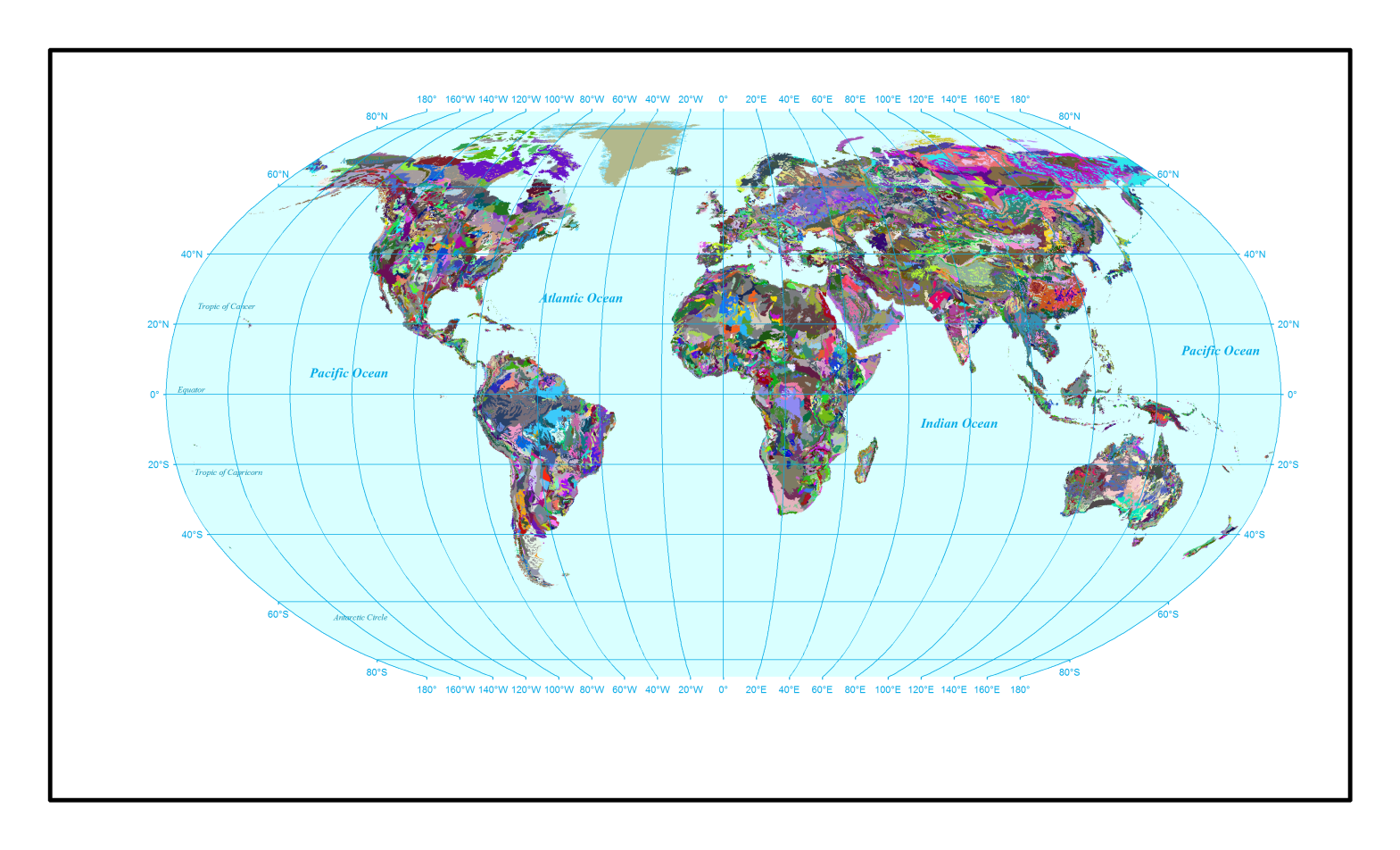
Global_Soil_FAO-UNESCO
The world's FAO/UNESCO soil map was prepared using the topographic map series of the American Geographical Society of New York at a nominal scale of 1:5,000,000, consisting of a 30 cm topsoil layer and a 70 cm subsoil layer.
Associated files include: "Lookup_Soil_FAO-UNESCO.txt", and "SWAT2012.mdb". These files are directly usable in ArcSWAT models. The database contains parameters from 4,932 soil units globally.
The provided soil map has the "WGS-84 Spatial reference" without projection.
The users will have to project this map before using it in ArcSWAT or QSWAT.
Download related article from "Nature Scientific Data":
https://www.nature.com/articles/s41597-019-0282-4